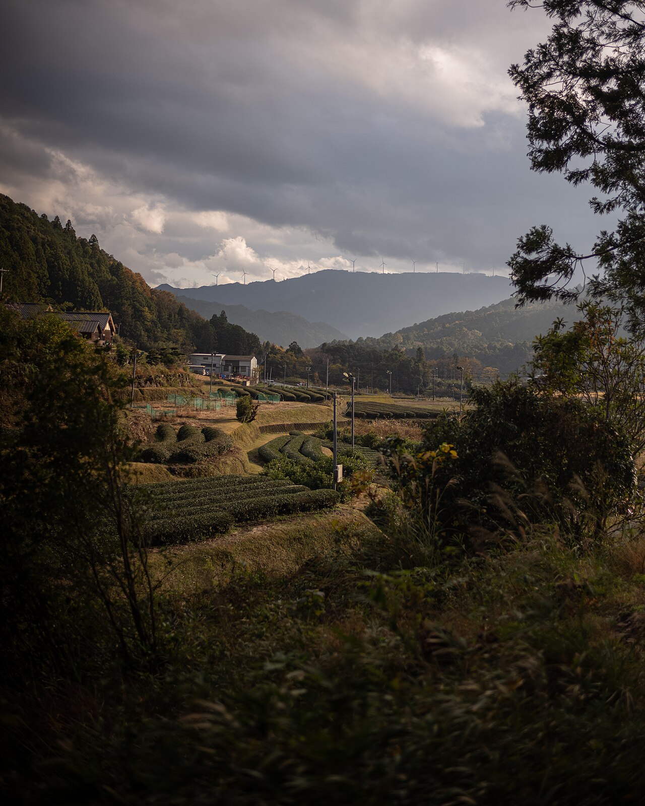
The first thing that hits you at Onigajo isn’t the rocks. It’s the wind. The Pacific opens straight onto this stretch of coast with two thousand kilometres of fetch behind it and nothing in the way, and the resulting gale-force gusts have been at work on the volcanic tuff cliffs for about 1.5 million years. The result is a linear city of wave-carved caves, blowholes, knife-edge ridges, and stepped rock platforms that run for 1.2 kilometres along the shoreline of Kumano in southern Mie Prefecture. At the south end of the stretch is a 25-metre sea stack that locals have called Shishiiwa — “Lion Rock” — for so long that the name predates Japan itself having a meaningful coastal tourism sector.
In This Article
- Quick facts
- What Onigajo actually is (geologically)
- The walk: what to expect on the 1.2km path
- Shishiiwa: the Lion Rock
- The offshore island (Mamigashima)
- The Kumano Kodo connection
- Getting there and logistics
- Where to stay
- Food and the local specialty
- Is Onigajo worth the trip?
- FAQ
- Is the cliff path safe in bad weather?
- Can I swim at Shichiri-mihama beach?
- Is there an entrance fee?
- How long should I allocate?
- Is there English signage?
- Can I visit Hanano-iwaya shrine easily?
- Is it a good trip for kids?
The Japanese name for the whole 1.2km cliff complex is Onigajo (鬼ヶ城, Onigajō, literally “demon’s castle”), and it comes from the local folk tradition that pirate-raiders used the rock caves as a fortified hideout in the late Heian period. Whether that’s true (there’s archaeological evidence for 16th-century Muromachi-era castle ruins on the hilltop above the cliffs) or whether it’s a story to make the rocks more memorable than they already are, the name has stuck for 800 years. The whole site is a UNESCO World Heritage listing as part of the Sacred Sites and Pilgrimage Routes in the Kii Mountain Range, a nationally designated Natural Monument, and one of Japan’s officially designated “100 best views.” And almost no foreign tourists come here.
Quick facts
- Where: Kinomoto-cho 1835, Kumano City, Mie 519-4325. Southern tip of Mie Prefecture where the Kii Peninsula meets the Pacific.
- Getting there: JR Kumano-shi Station (on the JR Kisei Main Line) — 5 min local bus to Onigajo Higashi-guchi stop. From Nagoya: Nanki limited express, 3 hours 30 min, ¥7,830. From Osaka: Kuroshio limited express to Shingu then transfer, 4 hours, ¥8,930.
- Hours: Cliff trail open 24/7 but only advisable 6am-sunset. Onigajo Center (gift shop, restaurant, info) 8:30-17:00. The path is unlit and genuinely dangerous after dark.
- Cost: Free. No entry fee for the cliff path or the trails. The nearby Onigajo Center restaurant does a reasonable seafood lunch from ¥1,500.
- When to go: Morning on a clear day in spring or autumn. Summer afternoons get brutally hot and the exposed cliff path gives no shade. Winter can close the path if a typhoon system is in the region — check the local forecast.
- Official: Mie Tourism Official, English version.
What Onigajo actually is (geologically)
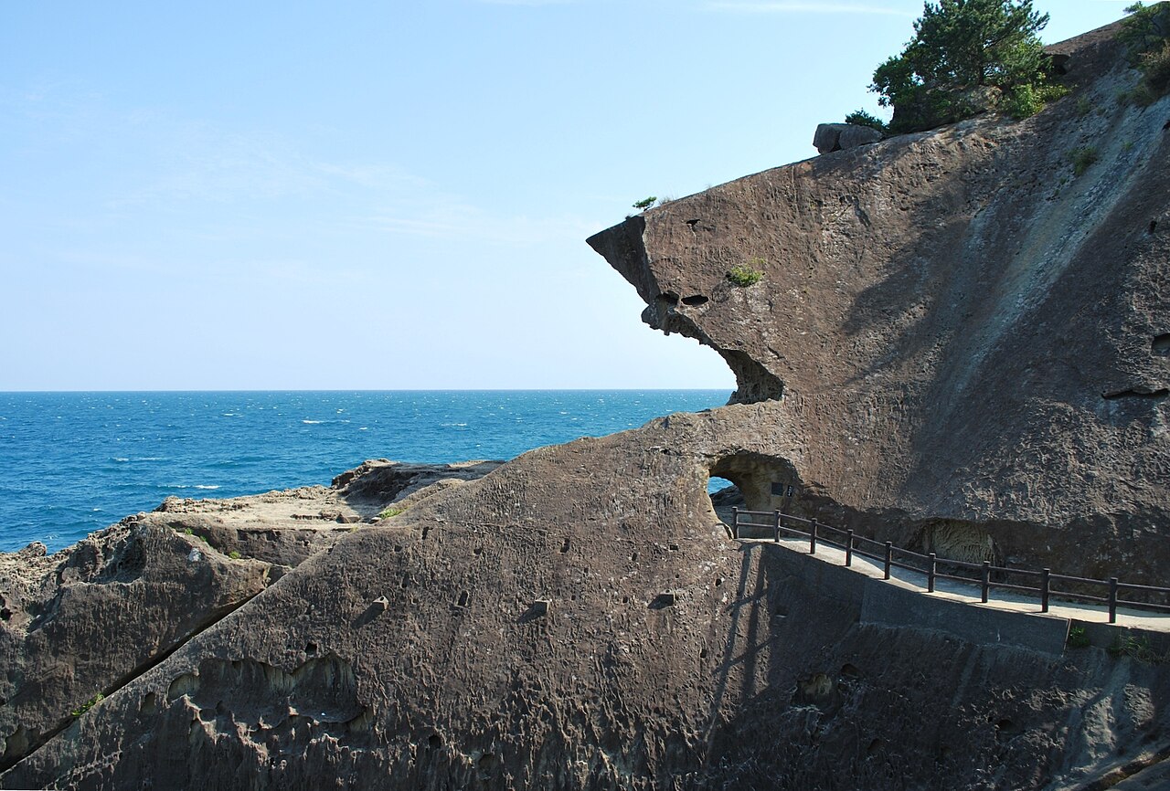
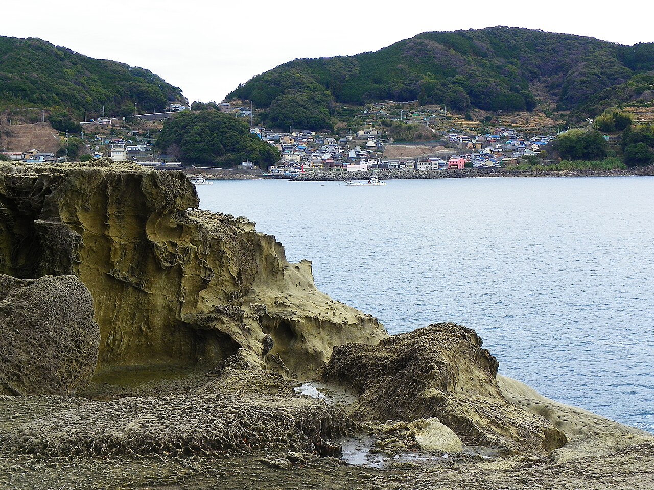
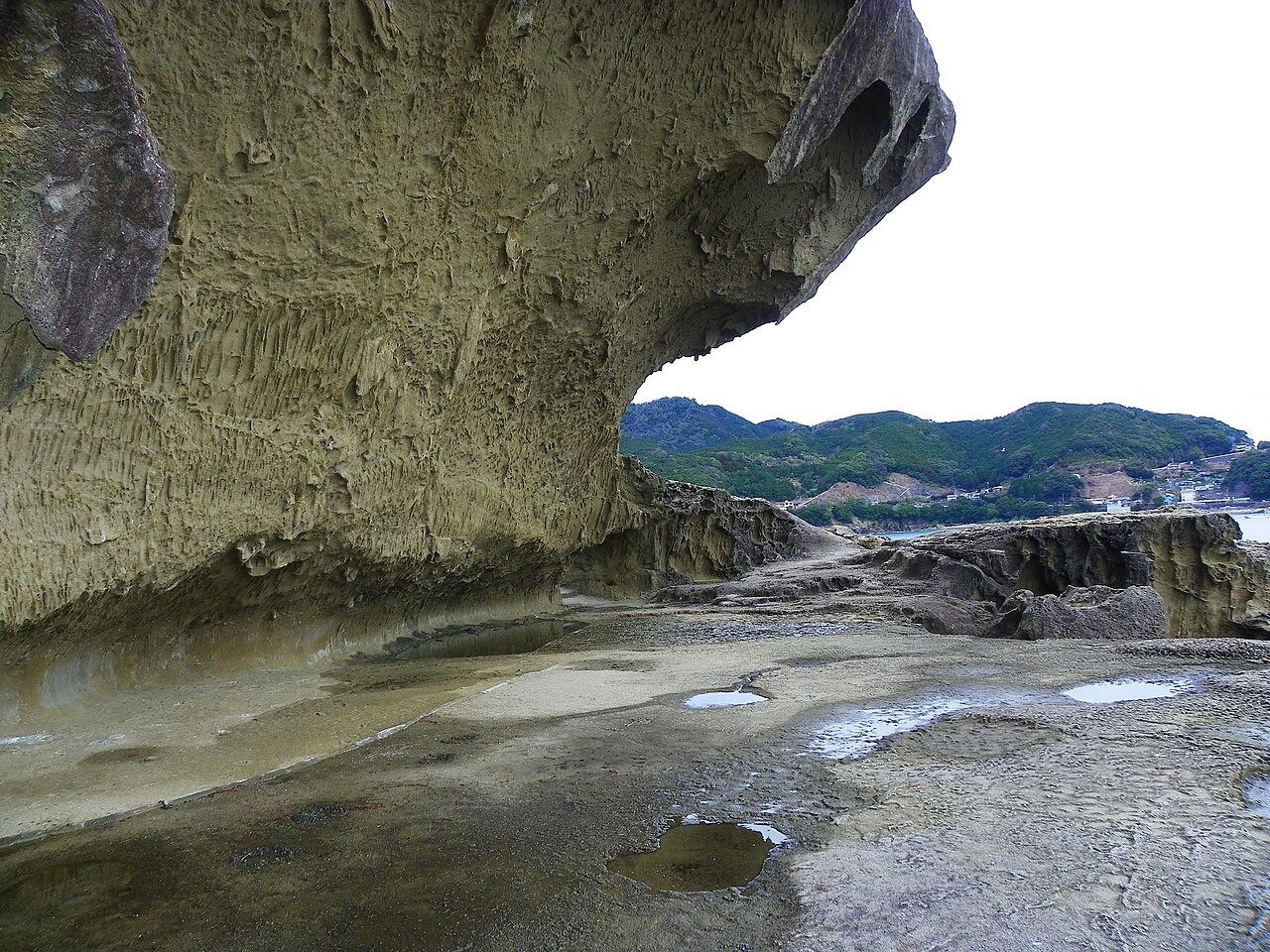
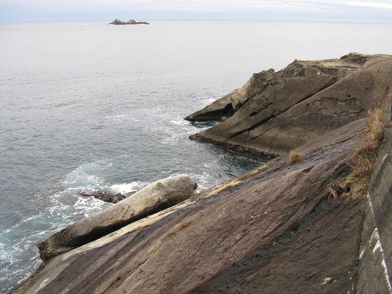
The cliff system is a 1.2-kilometre stretch of coastal volcanic tuff uplift — the rock itself is hardened volcanic ash from Miocene-era eruptions, about 15 million years old, pushed above sea level by a combination of tectonic uplift and the slow rise of the Kii Peninsula. The wave erosion has specifically exploited the alternating hard-soft layers of the tuff, carving horizontal slots where the softer beds have been eaten away faster. Walk the cliff path and you’ll see the mechanism in action: every cave is horizontal, every one sits at a former sea level, and the step-up from cave floor to cave floor is the rough record of how much the coast has risen.
The nationally-designated Natural Monument listing came in 1935. The UNESCO World Heritage inscription came in 2004, as part of the broader Kii Mountain Range sacred-sites complex that also covers the Kumano Sanzan shrines, the Kumano Kodo pilgrimage trails, and a dozen related temples.
The walk: what to expect on the 1.2km path
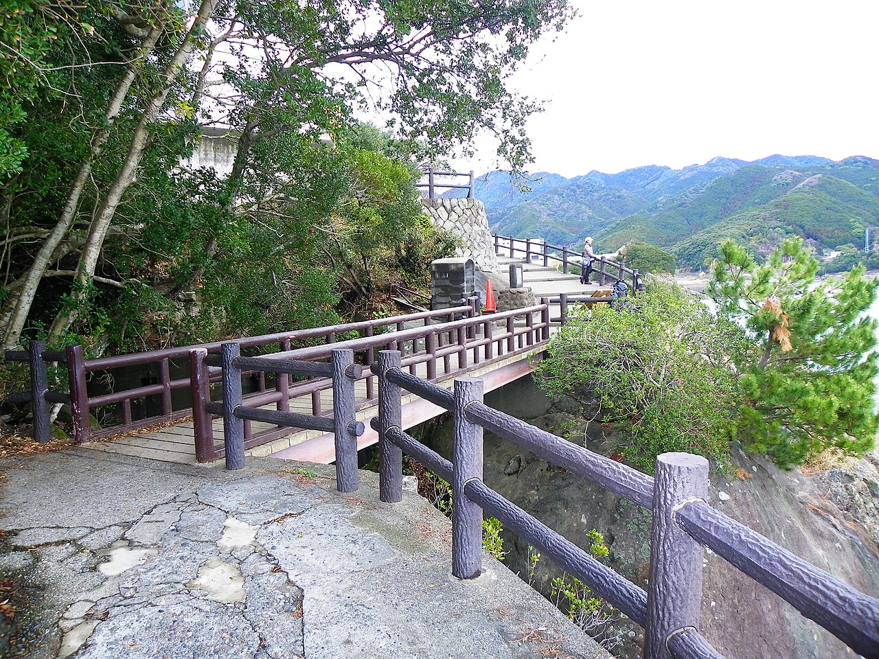
The main attraction is the Onigajo Yuhodo (鬼ヶ城遊歩道, “Onigajo promenade”) — a 1.2km cliff path that threads through the caves and rock formations at mid-cliff height. The path is narrow (roughly one person wide for most of the length), protected by steel railings on the seaward side, and includes sections that genuinely feel exposed on a windy day. Allow 30-40 minutes to walk the whole thing at sightseeing pace.
The named formations you’ll pass, in order from the north entrance:
- Gosen-jo (五千畳, “5,000-mat floor”) — a large flat rock platform at the northern end, named for its size (the jo unit is the standard Japanese measure for a tatami mat; 5,000 mats = about 8,250 square metres).
- Umibozu-iwa (海坊主岩) — “sea monk rock,” a cave shaped like a robed figure.
- Senjogiki (千畳敷, “thousand-mat floor”) — the most-photographed section, a smaller wave-cut platform that runs flat at mid-height like a stepped marble floor.
- Tofu-iwa (豆腐岩, “tofu rock”) — a cube of perfectly-jointed rock that looks like a block of tofu.
- Tategami-iwa (立神岩, “standing deity rock”) — a vertical pillar where a small shrine still operates.
- Shishiiwa (獅子岩, “lion rock”) — the southern endpoint and the headline photograph.
A practical note: the path is one-way signed but physically two-way. Most walkers enter from the northern Onigajo Center, walk south, exit at the Shishiiwa end, and either bus back (15 min) or walk the 20-minute road route back. Doing the reverse (entering south at Shishiiwa) works fine and tends to have fewer people.
Shishiiwa: the Lion Rock
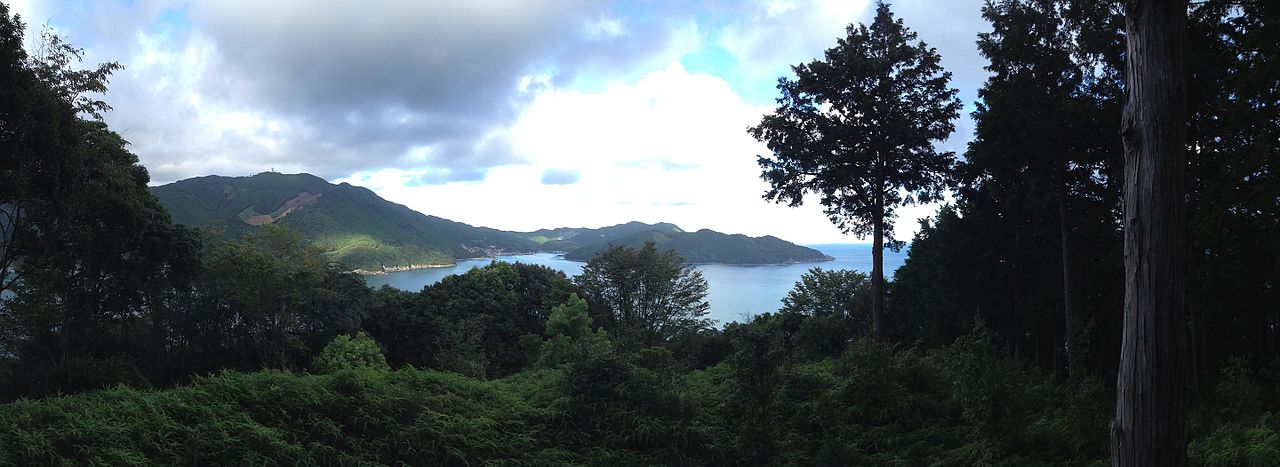
The southern endpoint deserves its own section. Shishiiwa is a 25-metre-tall sea stack at the north end of the Shichiri-mihama (七里御浜, “seven-league sacred beach”) — the 22-kilometre continuous black-sand beach that stretches south from Onigajo to Kumano-shi town. The rock is a free-standing tuff pinnacle that has eroded into a profile that looks, from the main road viewpoint, precisely like a lion’s head roaring toward the Pacific.
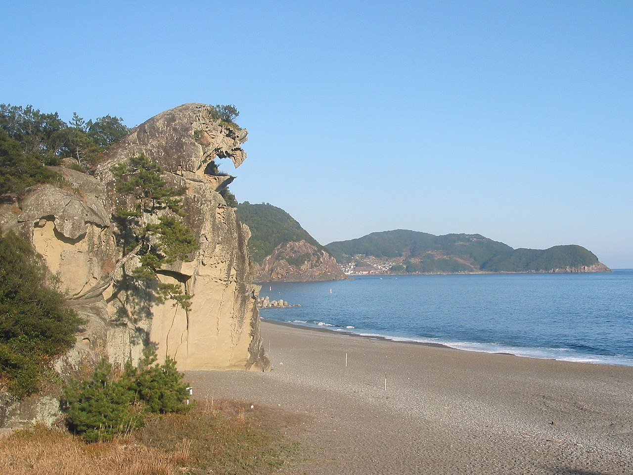
The pareidolia is strong — once you’ve seen it, you can’t unsee it. Local tradition takes the likeness seriously: Shishiiwa is considered a guardian of the Hanano-iwaya Jinja (花の窟神社, “flower cave shrine”) a short walk inland, one of the oldest shrines in Japan and recorded in the 8th-century Nihon Shoki. Hanano-iwaya is a shrine without a building — it’s just a 45-metre-tall rock face that people have prayed at for over 1,500 years — and the mythology explicitly links the Lion Rock to the Flower Cave as guardian-and-site.
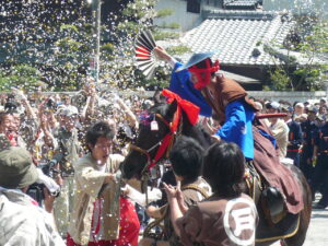
A note on the myth, because the Kumano-region folklore is unusually dense and rewards the detour: Hanano-iwaya is recorded in the Nihon Shoki (720 CE) as the burial place of the creator-goddess Izanami, who died giving birth to the fire god Kagutsuchi; the 45m rock face is supposed to be her grave marker. Twice a year — February 2 and October 2 — local priests still perform the Otsunakake Shinji, a rope-tying ceremony in which a 170-metre ceremonial rope is hauled up and draped across the rock face. It’s one of the older continuously-performed Shinto rituals in Japan and completely un-touristed.
Practical: Shishiiwa is best viewed from two specific spots. The main one is the viewing platform off Route 42 on the beach-side shoulder — parking for about 10 cars, a pedestrian crossing, and a signboard with the lion-profile overlay. The second is from the south end of the Onigajo cliff path, where you look back at the rock from sea level. First trip: do both.
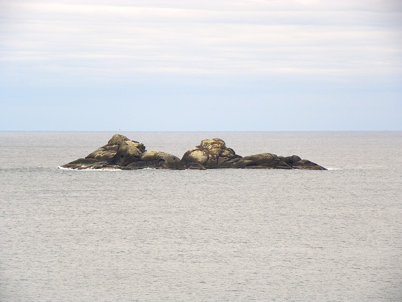
The offshore island (Mamigashima)
Mamigashima (孔島) is a small uninhabited rock island about 300m offshore, visible from most of the Onigajo cliff path. It’s not accessible to the public — no boat service, no swim — but it’s a visual anchor for almost every northward photograph from the promenade.
The Kumano Kodo connection
Onigajo isn’t an isolated sight — it sits on the Kumano Kodo Iseji (熊野古道伊勢路), the eastern of the five ancient pilgrimage routes connecting the Ise Grand Shrine in the north with the three Kumano Sanzan shrines (Hongu, Nachi, Hayatama) in the south. The Iseji route runs 170km along the Pacific coast and has been walked continuously since at least the 10th century — UNESCO inscription in 2004 recognised it alongside the Santiago de Compostela as one of only two pilgrimage routes with World Heritage status.
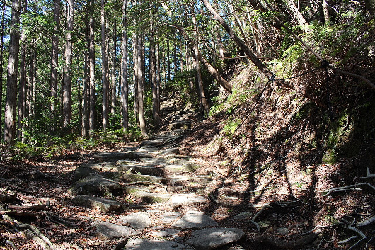
For day visitors to Onigajo, the Kumano Kodo connection is useful context — but if you have a full day (or three), doing a section of the Iseji on foot is a natural extension. The closest walkable section is the Magose Pass (馬越峠), a 2-hour stone-paved trail through old cypress forest, starting a 15-minute drive north of Onigajo. The whole Iseji is well-marked in English.
Getting there and logistics
Onigajo is in the far south of Mie Prefecture, closer to Wakayama than to Nagoya. Access is specifically about the JR Kisei Main Line, which is the long single-track rail that circles the Kii Peninsula’s coast. The line has limited services — check schedules before you commit to a same-day return.
From Nagoya: JR Nanki limited express (direct to Kumano-shi Station), 3 hours 30 minutes, ¥7,830. About six services per day; the 07:58 Nanki 1 is the useful one if you want a full day on-site.
From Osaka: JR Kuroshio limited express to Shingu (4 hours), transfer to JR Kisei local train to Kumano-shi (30 min). ¥8,930 total. Fewer direct services than from Nagoya.
By car: Isewangan Expressway from Nagoya to Owase, then Route 42 south along the coast. About 3 hours driving total. Free parking at Onigajo Center (50 spaces, fills on peak weekends).
Local bus from Kumano-shi Station: Mie Kotsu bus to Onigajo Higashi-guchi (5 min, ¥180) or to Shishiiwa (8 min). The buses run roughly hourly during the day, less often on weekends; check the timetable at the station.
Where to stay
Kumano-shi town itself has thin accommodation — three or four small business hotels (¥7,000-11,000 for a twin) and a handful of minshuku (family-run guesthouses). The better options are in Shingu (30 min south on the Wakayama side), a proper-sized city with the Hongu shrine nearby and much broader hotel inventory.
For a ryokan-and-onsen experience, head to Yunomine Onsen or Kawayu Onsen in the mountains inland (1 hour from Kumano-shi). Both are UNESCO-inscribed pilgrimage rest-stop towns, and both have the specifically river-and-rock onsen experience that you can only really get on the Kumano Kodo.
For a day trip, it’s easier to use Nagoya as a base and spend 4-5 hours round-trip on the train. Nagoya has a full hotel spread at ¥7,000-15,000 and you can do Onigajo as a long day.
Booking.com’s Kumano listings cover the local options.
Food and the local specialty
Kumano coast food centres on two things: seafood from the Pacific (especially katsuo bonito in summer and tuna year-round), and the Mehari-zushi (めはり寿司) — a locally-specific sushi-style rice ball wrapped in a pickled leaf mustard leaf. Mehari-zushi is a pilgrim food (easy to carry, keeps for a day, filling) and you’ll see it sold from roadside stalls all along the Kumano Kodo. Budget ¥800-1,200 for a set of four.
The Onigajo Center restaurant does a reasonable kaisendon (seafood rice bowl) from ¥1,500 at lunch, featuring the day’s Kumano catch. For a better sit-down meal, head to Kumano-shi’s small harbor restaurants where the tuna sashimi comes off the boats that morning — the town has no Michelin pretensions but the raw-fish quality is at a level that Tokyo mid-range places couldn’t match.
Is Onigajo worth the trip?
For travellers already doing the Kumano Kodo — absolutely. Onigajo is a natural half-day on the Iseji route and pairs with any of the inland mountain passes for a full coastal-plus-forest day.
For travellers doing the broader Kii Peninsula loop (Ise Grand Shrine + Kumano Sanzan + Koyasan) — yes, it fits as a stop between Ise-Shima and the Wakayama side. Budget a half-day.
For a focused Nagoya-and-region trip — worth it if you’ve got 3+ days in the Nagoya region and want a deep-coastal day. The 3.5-hour rail journey each way makes it a full-day commitment.
For a first-time Japan trip with Tokyo and Kyoto already booked — probably not. Onigajo is extraordinary but it’s deep-travel; the rail journey and remote position mean you’d be spending a full day on a very specific piece of coast.
For photographers and geologists — unambiguously yes. The rock formations are some of the best coastal geology in Japan, the light is spectacular in the right conditions, and the lack of other tourists means you can take a considered photograph without waiting for someone to get out of the frame.
FAQ
Is the cliff path safe in bad weather?
Marginal. The path is officially open year-round but the Kumano City website posts closure warnings during typhoons (typically late August through October). Heavy rain can wash debris onto the trail. The path is never safe in a genuine storm — even medium winds push you off-balance in the exposed sections, and the spray from the cliff-base waves can come over the railings on rough days. Check the weather; if in doubt, skip it and come back.
Can I swim at Shichiri-mihama beach?
Technically yes but not advisable. The beach is a 22-kilometre continuous black-sand stretch that slopes steeply into the Pacific — the undertow is strong and there are no lifeguards. Japanese domestic tourism doesn’t really treat Shichiri-mihama as a swimming beach; it’s a walking and photography beach. Signed “swim at your own risk” in multiple languages.
Is there an entrance fee?
No. The Onigajo cliff path, Shishiiwa, and the surrounding national park are all free. The only paid extras are food, souvenirs, and bus fares.
How long should I allocate?
Minimum 90 minutes (walk the cliff path, photograph Shishiiwa from Route 42). Half a day if you want to do the Hanano-iwaya shrine and the Onigajo Center’s museum display as well. A full day if you’re combining with the Magose Pass section of the Kumano Kodo.
Is there English signage?
Yes, actually — better than you’d expect for a remote site. The UNESCO designation led to a trilingual (Japanese / English / Chinese) signage upgrade through the mid-2010s, and most of the key rock formations have interpretive plaques with English descriptions. Mie Kotsu bus times are less comprehensive but fine with Google Translate.
Can I visit Hanano-iwaya shrine easily?
Yes — it’s a 20-minute walk inland from the southern end of Shichiri-mihama beach, or a 5-minute bus ride. The shrine itself is a 45m rock face with no building; the annual rope-tying ceremony (February 2nd and October 2nd) is worth timing around if you’re flexible. Free entry, open 24/7.
Is it a good trip for kids?
Yes, with caveats. The cliff path is narrow and exposed — keep young children on the inside hand and watch for wind gusts. The walk takes 30-40 minutes and younger children (under 5) will find it long. The Onigajo Center at the north end has a café and playground area that’s genuinely useful as a break point. Older kids love it — the rock formations look like something from a fantasy video game.

.JPG)