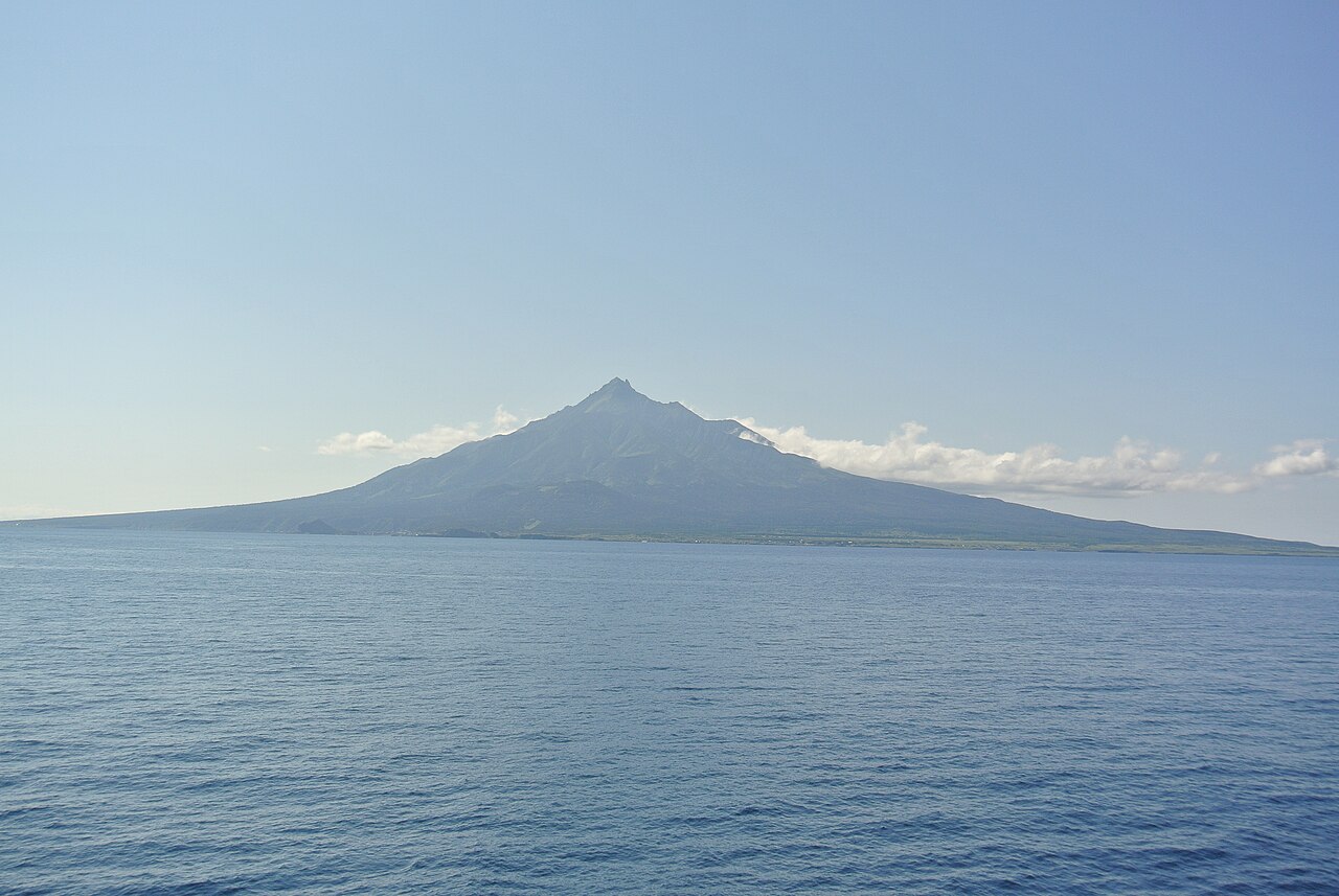
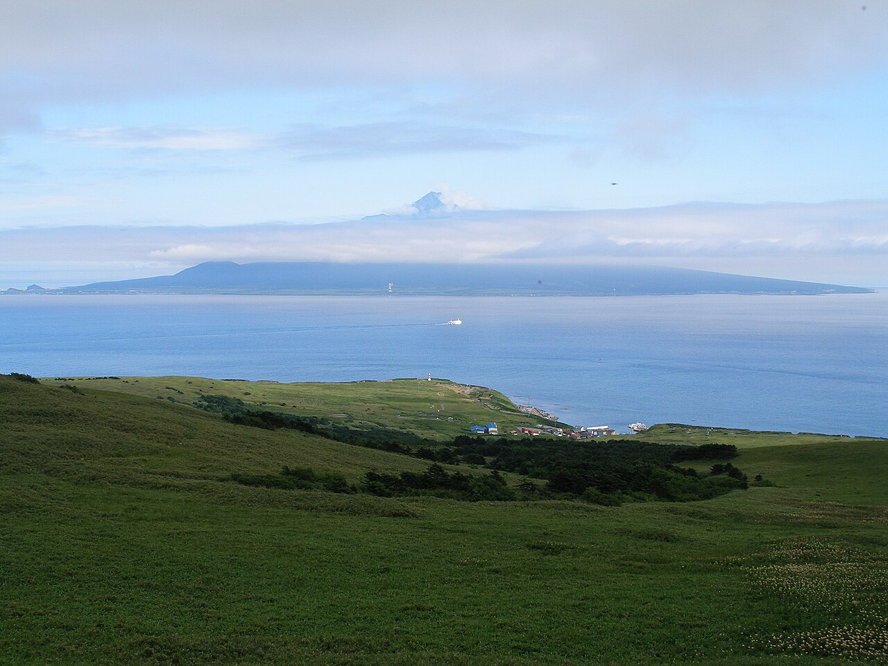
At the top of Hokkaido, fifty kilometres beyond the last railway station of mainland Japan, sit two small islands and the strip of coastal wetland they share a national park with. Rishiri (利尻, Rishiri) is the volcanic one — a single 1,721-metre cone rising out of the Sea of Japan, shaped so precisely like Mount Fuji that the locals call it Rishiri-Fuji (利尻富士) and put its silhouette on everything from the local beer to the ferry terminal logo. Rebun (礼文, Rebun) is the floral one — a long, narrow ridge that was part of the Asian mainland until the last ice age and whose isolated flora includes more than a dozen alpine plant species found nowhere else in Japan. Together with the Sarobetsu coastal wetland on the mainland opposite, they form the Rishiri-Rebun-Sarobetsu National Park (利尻礼文サロベツ国立公園, Rishiri-Rebun-Sarobetsu Kokuritsu Kōen), one of Japan’s most northerly and most visually distinct protected areas.
In This Article
- Quick facts
- What the park actually is
- Rishiri: climbing the mountain and circling the island
- Rebun: the flora-flower ridge
- The double-island view (both ways)
- Getting there from Tokyo (and planning around the weather)
- Where to stay
- Food: the sea urchin angle
- Is Rishiri-Rebun worth the journey?
- Combining with the rest of Hokkaido
- FAQ
- When exactly is the flower season on Rebun?
- Can I do both islands in one day?
- Do I need special gear for Mt Rishiri?
- Are there English guides or signage?
- Is the inter-island ferry reliable?
- What’s the story with the Russian coast nearby?
- Is the seafood as good as people say?
This is deep-Japan travel. The islands see around 110,000 visitors a year — less than Tokyo Tower gets on a single busy weekend — and most of them are Japanese domestic tourists. Foreign visitor numbers are measured in the low thousands. The flight from Tokyo takes longer than some intercontinental journeys, the ferry from Wakkanai runs only four times a day, and when you’re actually there, the landscape is closer to Scotland’s Hebrides than to anything most people have on their mental map of Japan. For exactly that reason, this is where you should be once you’ve done the main-island circuit and want to see a different Japan.
Quick facts
- Where: 50km off the northwest tip of Hokkaido. Rishiri circumference 60km; Rebun 72km end-to-end but narrow. Sarobetsu Plain on the mainland, south of Wakkanai.
- Getting there: Fly Tokyo (Haneda) → New Chitose → Wakkanai (3 hours total, ¥35,000-50,000 depending on season). Wakkanai Ferry Terminal → Oshidomari (Rishiri) or Kafuka (Rebun), 1 hour 40 min each, ¥3,110. Direct flights from Sapporo-Okadama and New Chitose to Rishiri Airport also operate June-September.
- Hours: Islands operate year-round but the tourist season is late May to early October. Outside that window, many restaurants, buses, and guesthouses close.
- Cost: National park free. Rishiri ropeway-style attractions don’t really exist. Mt Rishiri climb: free, self-led (¥1,000 suggested conservation donation). Ferry between islands ¥900. Bus day-passes ¥2,000 on either island.
- When to go: Peak window is late June to early August — all the alpine flowers bloom, all the trails are snow-free, and the weather is reliable enough to fly back on schedule. May is too early; October too late; winter is for specialists only.
- Official: Ministry of Environment park page, Rishirifuji town tourism, Rebun Island Tourism.
What the park actually is
Rishiri-Rebun-Sarobetsu National Park has three disconnected parts that tourism usually treats as a single unit:
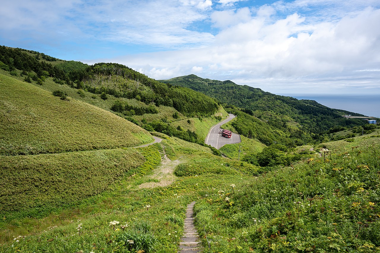
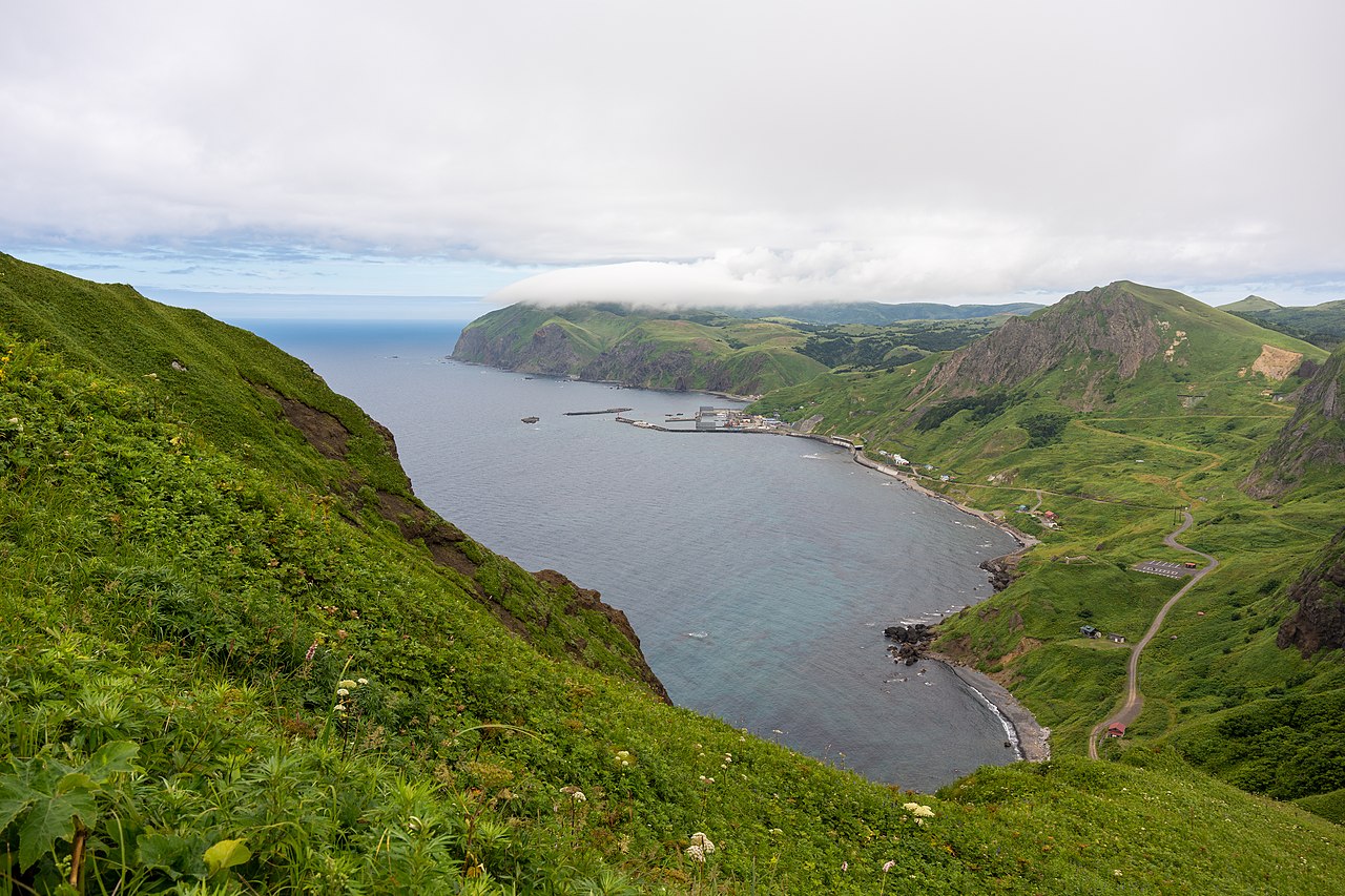
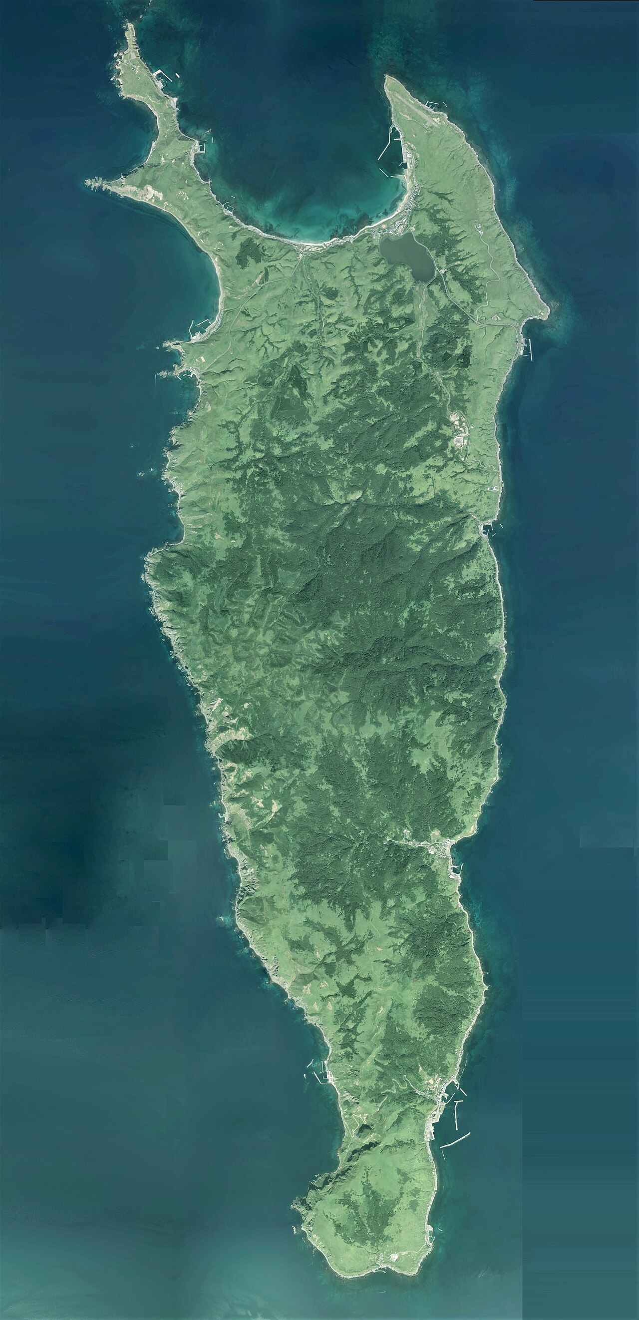
Rishiri Island (利尻島) is the volcanic one. A single dormant stratovolcano rises from the sea to 1,721 metres at its summit — the whole island is essentially one mountain and its shore. About 5,000 people live on Rishiri, split between two small towns (Oshidomari on the north coast, where the main ferry arrives, and Kutsugata on the west). The island can be circumnavigated by bicycle in a very long day (60km, two big headlands), on a bus in three hours, or by car in 90 minutes.
Rebun Island (礼文島) is the floral one. Long and narrow (22km by 6km), with a spine of hills rising to about 490 metres at Mt Rebun. About 2,500 residents, clustered mostly at Kafuka on the south coast (where the ferry arrives). Rebun’s claim to fame is its flora — 300+ flowering plant species including over a dozen endemic or near-endemic ones — and the eight marked hiking trails that follow the island’s spine.
Sarobetsu Plain (サロベツ原野) is the mainland part. A 7,000-hectare coastal wetland on the Japan Sea coast south of Wakkanai, noted for migratory birds (whooper swans, cranes) in spring and autumn, and for a specific low-lying subarctic flora that lives only in this specific climate band. A boardwalk circuit and a visitor centre anchor the tourism infrastructure; otherwise the plain is left to itself.
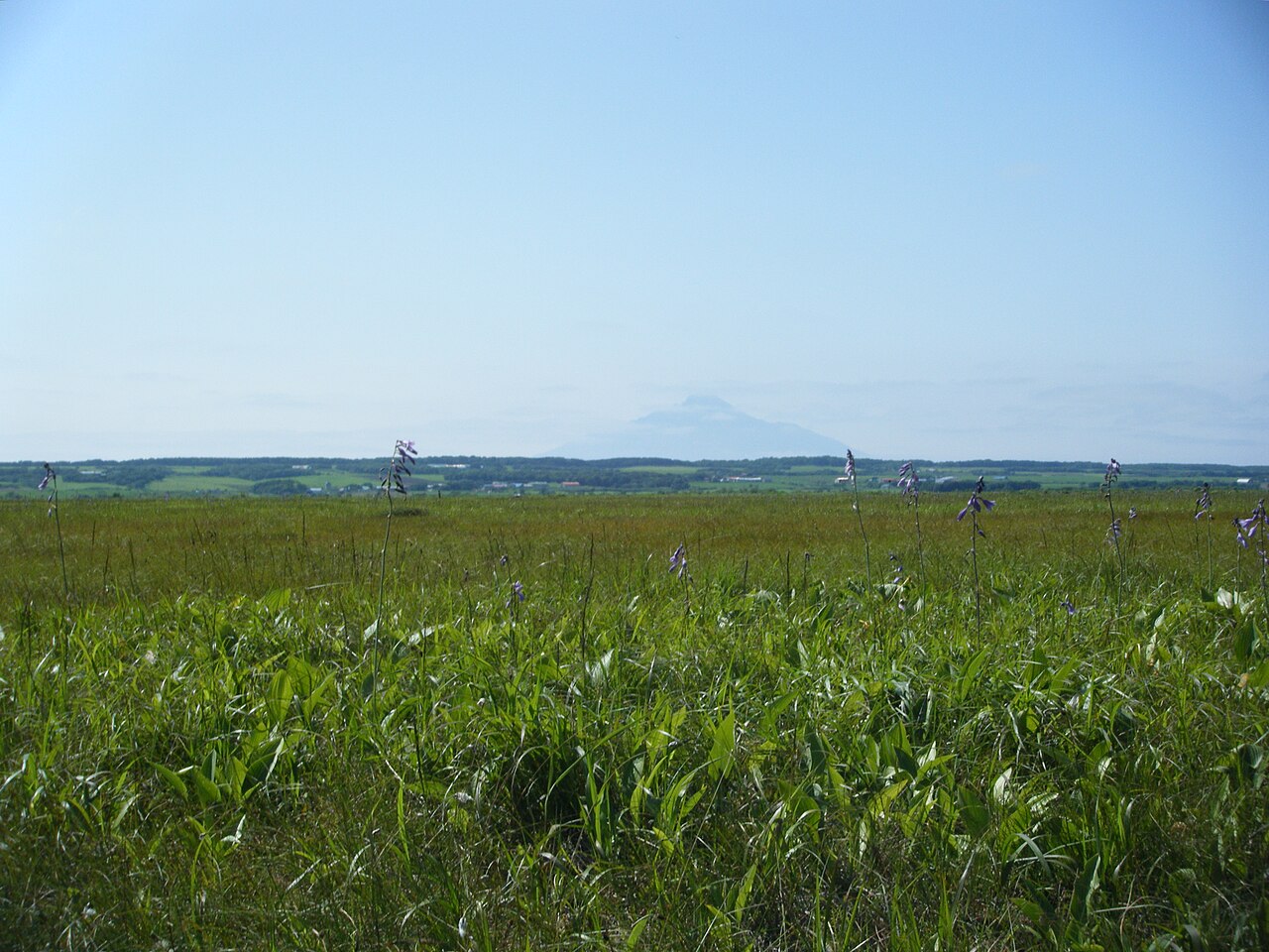
Most visitors do the islands as a 2-3 night trip and skip Sarobetsu. If you have one extra day, the plain rewards it — the wetland flora is completely different from the alpine flora on the islands, and the bus from Wakkanai station passes the visitor centre on its way to the ferry terminal.
Rishiri: climbing the mountain and circling the island
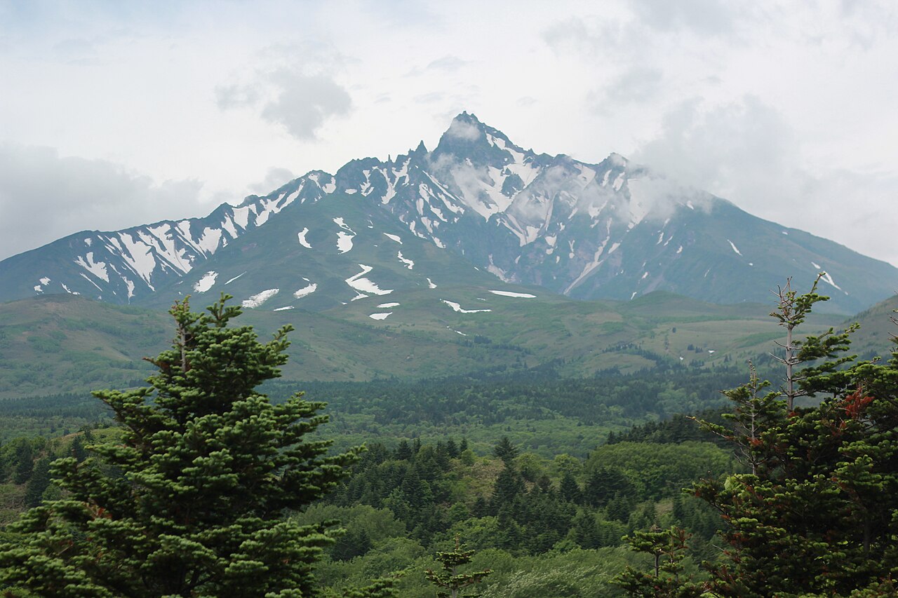
The defining Rishiri experience is the summit climb. Mt Rishiri (利尻山, also Rishiri-zan) has one main ascent route (the Oshidomari Course from the north) plus a secondary longer route (the Kutsugata Course from the west). Both end at the same 1,721m summit. The standard Oshidomari climb is 10km round-trip with 1,500m of ascent, starting at the Hokuroku Campground trailhead, and takes the average hiker 8-10 hours. It is not a casual hike — the upper portion above the 8th station (8合目) is loose volcanic scree, the weather above 1,000m can shift from sunny to whiteout in twenty minutes, and the island’s maritime position means rapid fog even in peak summer.
Climbing season is late June to early October; July-August is the safest window. The Rishiri Nature Conservation Fund asks climbers to leave a ¥1,000 donation at the trailhead kiosk — this is voluntary but widely observed, and the money funds trail maintenance and toilet waste removal (there’s a surprisingly serious problem with climber waste on the upper slopes). Bring a 携帯トイレ (portable toilet) if you plan to spend more than 4 hours on the mountain; they’re sold at the kiosk for ¥500.
If you’re not climbing the mountain, the alternative is the Rishiri circumnavigation — bike, bus, or car around the 60km coastal loop. Bike is the most rewarding if the weather cooperates: rental shops in Oshidomari have road bikes and e-bikes for ¥2,500-5,000 per day, and the coastal road is flat, paved, and light on traffic. You’ll want a full day; most people take 6-8 hours with stops. The stops that matter:
Himenuma Pond — a kettle lake on the north slope, visible from the summit of the volcano’s shoulder, with a 2km boardwalk around it. The classic reflection shot (volcano mirrored in lake water) is taken from the north shore, early morning before the wind picks up.
Otatomari-numa Pond — the larger kettle lake on the southeast slope, quieter than Himenuma, with a boardwalk that runs for 1.5km through subarctic wetland. Ezo deer (Hokkaido sika) are usually visible on the far shore.
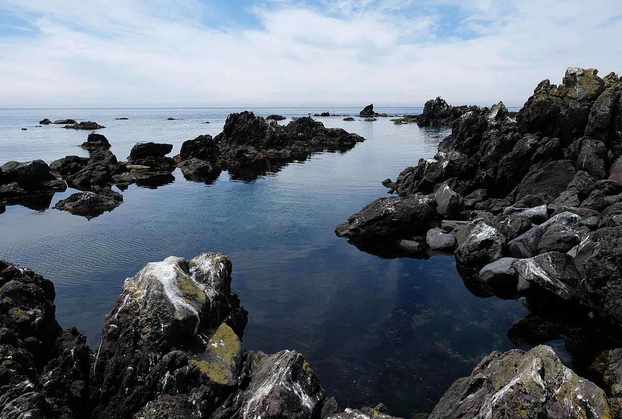
Senhoshi Misaki Park — the lava-rock headland on the south coast, where the Kutsugata Course trail begins. Worth stopping for the geology alone — the lava-rock tide-pools are some of the more photogenic on the island.
Kutsugata Port — the smaller of the two ferry ports, on the west coast. Worth stopping at a local restaurant here for uni-don (sea urchin rice bowl) at lunch if you’re making the full loop.
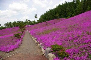
Rebun: the flora-flower ridge
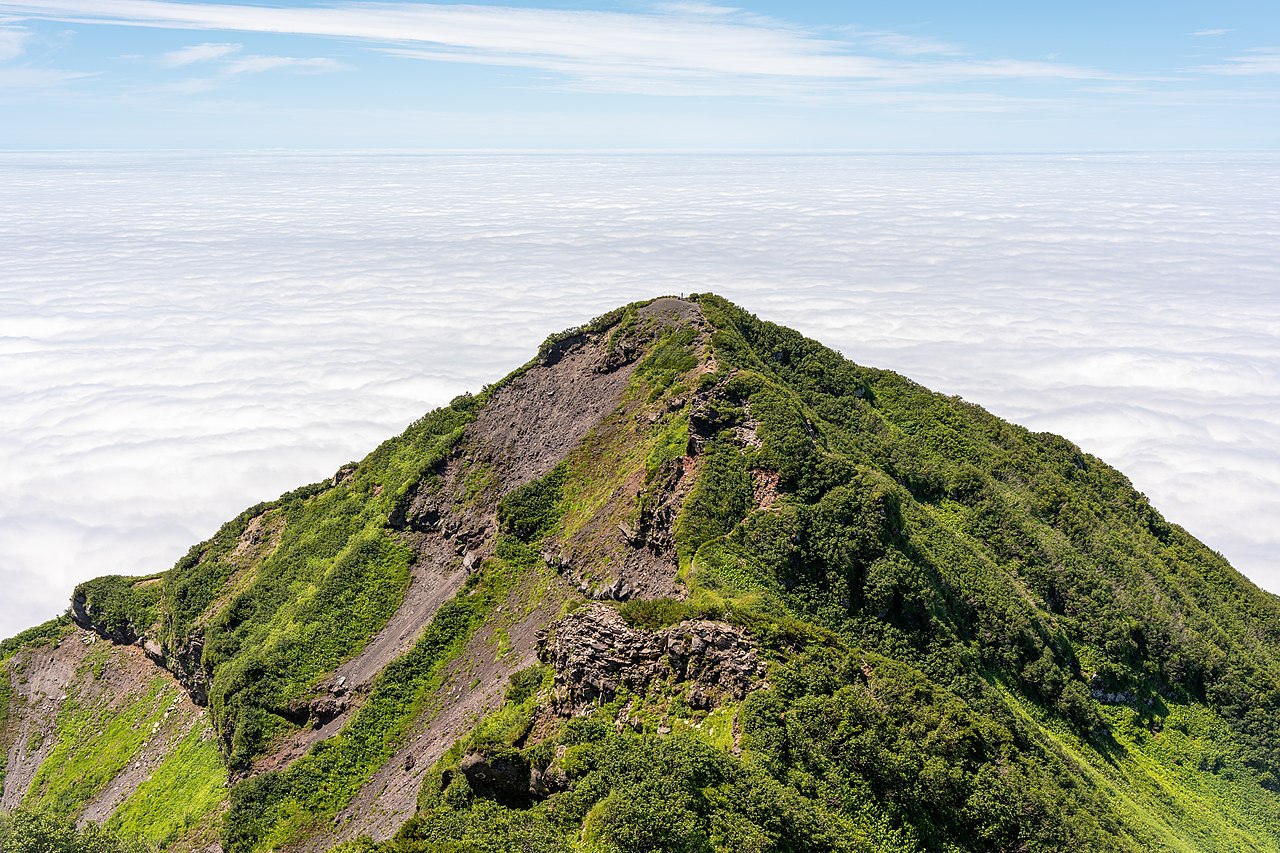
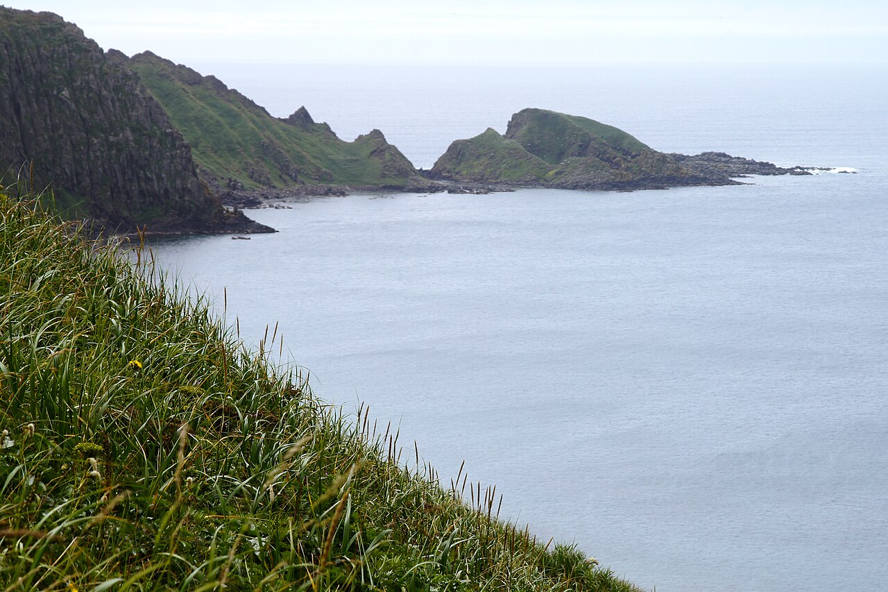
Rebun is a completely different island in character despite being 10km away. The spine of hills runs the length of the island, and the eight Rebun Trails (礼文島フォーラム・トレイル) follow various combinations of the ridge. The main trail system is curated by a local non-profit; trail maps are free at the ferry terminal and at the Rebun Visitor Center near Kafuka.

The highlight is the Cape-to-Cape Course (岬めぐりコース, Misaki Meguri Kōsu), an 8-hour, 14km walk from the island’s north tip at Cape Sukoton down the west coast to Cape Gorota. It’s the route that showcases the full range of Rebun’s flora, including the famous Rebun atsumori-so (礼文敦盛草, “Rebun lady’s slipper”) — a pink-flowered orchid endemic to the island, flowering mid-May to early June in a protected area near the Momo-iwa (“peach rock”) trailhead. The trail itself is rated moderate — very little elevation change, mostly rolling ridge-walk with occasional steep sections down to sea-level at the headlands.
For shorter walks, the Momo-iwa trail (1 hour round trip from the trailhead car park) takes you to a panoramic viewpoint near the island’s famous peach-shaped sea-stack; the Sukoton Misaki walk (30 min round trip) covers the island’s northern-tip lighthouse; and the Kushu Pond trail (2 hours round trip) covers a kettle lake near the island’s eastern coast.
The double-island view (both ways)
One of the specific pleasures of Rishiri-Rebun is that each island has the other as its own signature view. From Rebun’s western trails, Rishiri-Fuji dominates the southern horizon — a near-perfect cone, often with a cap of cloud at its summit, visible from any high point on the western ridge. From Rishiri’s ropeway-less but still-walkable summit shoulder, Rebun is a long pale smudge to the north, visible as a continuous line from tip to tip.
For this reason most visitors try to do both islands rather than just one. The inter-island ferry (45 minutes each way, ¥900) runs two or three times a day depending on season, which makes a split stay (2 nights Rishiri, 1 night Rebun, or vice versa) the standard approach.
Getting there from Tokyo (and planning around the weather)
This is a journey, not a hop. From Tokyo:
By air (recommended): Tokyo Haneda → New Chitose (1.5 hours) → transfer to domestic Wakkanai flight (50 min). Total door-to-door about 6 hours including airport time. ¥35,000-50,000 return depending on season and booking window. Wakkanai Airport → ferry terminal by bus (30 min, ¥700). Then ferry to Rishiri or Rebun (1h40min, ¥3,110). Plan on 8-9 hours Tokyo → island guesthouse with transits.
Direct to Rishiri Airport: ANA Wings operates direct flights from Sapporo New Chitose to Rishiri Airport from mid-June to early September only (about 50 minutes). This skips the Wakkanai ferry transfer and is worth the cost if you’re on a short schedule.
By overnight ferry: Tokyo → Oarai → overnight ferry to Tomakomai on Hokkaido → train to Wakkanai (5+ hours) → island ferry. Roughly 36 hours total. For extreme-slow-travel enthusiasts or people travelling with cars; otherwise not recommended.
The weather factor: Rishiri-Rebun-Sarobetsu sits in a strong maritime weather zone and flights to Wakkanai are cancelled 10-15% of the time in summer due to fog. Ferries to the islands are cancelled 5-8% of the time for wind. Build a buffer into your schedule — never plan on catching a flight home the same day you’re on the islands. The standard failure mode is: you fly in, you do two days on the islands, you can’t ferry back because the strait is closed, you miss your Tokyo flight. Budget one extra day.
Where to stay
On Rishiri: most accommodation is in Oshidomari (the main ferry port). Small family-run minshuku start around ¥9,000 per night with dinner and breakfast; mid-range ryokan are ¥15,000-25,000. The higher-end option is Rishiri Marine Hotel on the north coast. Book at least 2 months out for the July-August peak.
On Rebun: most accommodation is in Kafuka (southern ferry port). Similar pricing to Rishiri with slightly thinner inventory. The standout option is the Hana Rebun, which sources dinner ingredients from the island’s own fisheries and has a small rooftop onsen with views across to Rishiri. ¥18,000-30,000 per person with dinner.
For mainland Sarobetsu or a Wakkanai base: the Wakkanai Grand Hotel and the ANA Crowne Plaza Wakkanai are the two proper hotels in Wakkanai city itself, both in the ¥10,000-16,000 range, both walking distance from the ferry terminal. Booking.com’s Hokkaido listings cover all three.
Food: the sea urchin angle
Rishiri-Rebun is the centre of Japan’s premium uni (sea urchin) production. Specifically the bafun-uni variety (short-spined yellow urchin, Hemicentrotus pulcherrimus) has its peak harvest season in June-August, and the local restaurants run seasonal menus that feature the daily catch. A proper uni-don (sea urchin rice bowl) from a ferry-port restaurant on Rishiri runs ¥4,500-7,000 — expensive by normal Japanese restaurant standards but well below what the same uni costs in Tokyo, and many times fresher.
Other local specialities: Rishiri kombu (利尻昆布) — the kelp used by Kyoto kaiseki chefs as the premium stock base; tsubu gai (whelk/sea snail); hokke (atka mackerel, usually served grilled); and matsuba-gani (snow crab) in autumn. Island restaurants are small and most close by 20:00 — eat early.
Is Rishiri-Rebun worth the journey?
For a repeat Japan visitor who’s done the main island circuit — yes, unambiguously. The islands offer a specific combination (sub-arctic alpine flora, volcanic summit climbing, working fishing-village culture, near-empty trails) that nothing else in Japan replicates. Even in peak July-August, the density of visitors is a fraction of any mainland national park, and the landscape is genuinely distinctive.
For hikers and wildflower photographers — this is a bucket-list destination. Rebun’s flora-walk and Rishiri’s summit ascent are two of the better outdoor experiences in the country and specifically reward travellers who want to be outdoors rather than moving between temples.
For a first-time Japan visitor on a two-week itinerary — almost certainly not worth the travel time. The transit alone consumes two days of a two-week window; the islands then want at least three more. That’s five of fourteen days on a very specific experience, and you’ll have skipped some combination of Kyoto, Osaka, or Hiroshima to make it happen.
For travellers specifically interested in extreme-north Japan — absolutely. Wakkanai itself is the northernmost city in Japan; Rebun is the northernmost sizeable inhabited island; and the specific latitude-dependent ecology is something you can’t see at lower latitudes.
Combining with the rest of Hokkaido
Rishiri-Rebun fits cleanly into a longer Hokkaido itinerary as the final deep-north stretch. Natural combines:
- Sapporo + Rishiri-Rebun (5-6 days): two nights Sapporo (city, Otaru, Jozankei onsen), fly to Wakkanai, three nights islands. Tight but workable.
- The full east-to-west Hokkaido loop (10-12 days): Sapporo → Furano and Biei → Asahikawa → Wakkanai → Rishiri-Rebun → back via Wakkanai. Good for cars and long-distance cyclists.
- Nationwide circuit extension: if you’re doing a “cover all 47 prefectures” trip, Rishiri-Rebun is the northernmost you can meaningfully get in mainstream tourism (the Russian-held Kuril Islands don’t count).
FAQ
When exactly is the flower season on Rebun?
The first wave of endemic spring flowers begins in late May (cherry-blossom-like trailside flowers). The peak alpine flower season is mid-June to late July — this is when you get the full suite of Rebun-endemic species in bloom, including the lady’s slipper and the thin-snow grass. August sees the summer flora in bloom (including the Rebun shiohigai, a coastal carnation); September sees the autumn grasses turning red before the season ends.
Can I do both islands in one day?
Physically yes — the inter-island ferry runs. In practice it’s a bad plan: you’d do one short hike on each island, spend four hours on ferries, and feel rushed. Recommend: one full day on each island at minimum. If you only have one day total, go to Rebun (the flora is more distinctive than Rishiri’s volcano views, which you can see from the ferry anyway).
Do I need special gear for Mt Rishiri?
Yes, but not specialist mountaineering gear. Proper hiking boots (ankle-high, grippy sole), a wind-shell jacket, a fleece or insulating layer for the summit (temperatures there can be 8-12°C cooler than the trailhead), 2-3 litres of water, trail food, headlamp in case you’re out late. A detailed map and basic GPS navigation. The mountain kills people most years, generally through exposure or falls on descent — take it seriously.
Are there English guides or signage?
Thin. Ferry terminals and major museums have English. Bus schedules are Japanese-only but the routes are simple. Trail signage is Japanese-only at most junctions — download the official maps before you go (the national park has English PDF maps). Most guesthouse hosts speak limited English; Google Translate’s camera function handles restaurant menus fine.
Is the inter-island ferry reliable?
Yes in summer (May-September). The 45-minute Rishiri-Rebun crossing is cancelled less than 5% of the time in peak season. In shoulder season (October, May-early), cancellation rates rise to 15-20% on windy days. The operator posts real-time status at each terminal.
What’s the story with the Russian coast nearby?
Sakhalin Island (historical Japanese name: Karafuto) sits 40km north of Rebun and is visible on clear days. The island was Japanese territory from 1905 to 1945 and there are still Japanese cultural sites and a small Japanese-descent community in southern Sakhalin. The border closed permanently in 1945 and you can’t legally travel between them today — though some Japanese specialised tours do visit from Russia-side airports.
Is the seafood as good as people say?
Yes, specifically the sea urchin in peak season (July-August). The Rishiri kombu kelp is a different thing — it’s the base ingredient for premium Kyoto stock and you can buy raw dried kombu for ¥2,000-5,000 per packet at the Oshidomari port market. One of the better food souvenirs you can bring home from Japan.
.jpg)
.jpg)
.jpg)