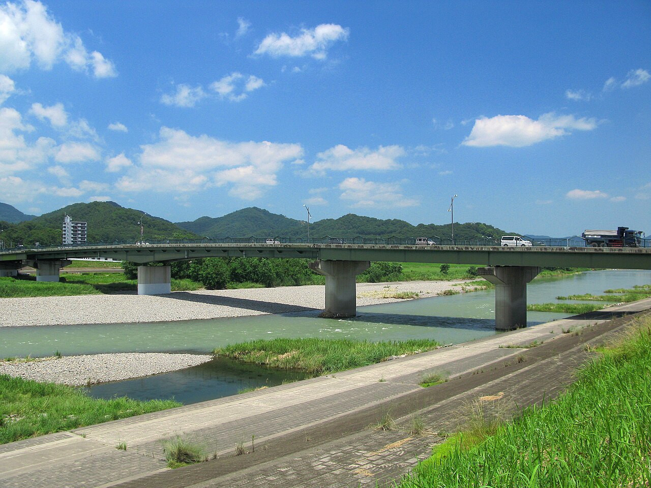
The Sakasagawa (逆川, Sakasagawa, “backward-flowing river”) is a small tributary stream in the Ashikaga district of southern Tochigi Prefecture. Despite the dramatic name — “backward-flowing” comes from the fact that its current runs north, against the prevailing southward flow of the Watarase River system it drains into — the Sakasagawa is a gentle suburban waterway, just 4 kilometres long end-to-end, with a walking path that runs along its north bank through some of Ashikaga’s quieter residential and agricultural districts. Nothing about it is famous. That’s the entire appeal.
In This Article
- Quick facts
- What the walking course actually is
- The seasonal character
- The Flower Walking Course context
- Nearby sites worth combining
- Getting there and walking it
- Practical notes
- Where to stay
- Is the walking course worth doing?
- FAQ
- Is the path signposted in English?
- Can I walk the whole Ashikaga Flower Walking Course?
- How bad is the summer heat on this path?
- Are there any specific views or photo spots?
- What else do locals do along here?
- How does this compare to walking along the main Watarase River?
For anyone who has done central Ashikaga’s set-piece sights (Banna-ji temple, Orihime Shrine, the Ashikaga School, the Flower Park) and wants to spend an afternoon walking through an everyday part of the city that domestic tourism doesn’t really reach, the Sakasagawa walking course is one of Ashikaga’s quieter options. It’s also part of the city’s informal “Flower Walking Course” (花のウォーキングコース), a route laid out by the municipal tourism board that connects a dozen or so small parks, temples, and riverside spots along a broader 10-kilometre loop through northern Ashikaga.
Quick facts
- Where: Sakasagawa River, northern Ashikaga City, Tochigi Prefecture. Stream runs approximately from the Ishibashi-cho area in the northeast to the Watarase River in the southwest, about 4km total.
- Getting there: JR Ashikaga Station → 15-20 min walk northeast to the stream’s lower course. By car: Kita-Kanto Expressway, Ashikaga IC, 10 min.
- Hours: Footpath accessible daylight hours, year-round. No entry fees or opening/closing times.
- Cost: Free. No infrastructure beyond a signed walking path.
- When to go: Late March to early April for the cherry-blossom bank trees. November for autumn colour. Avoid summer afternoons (no shade for stretches of the path).
- Length: About 3.5-4km along the stream; 60-90 min walk end-to-end. Part of a longer 10km Ashikaga city walking loop if you want it.
- Official: Ashikaga City Tourism.
What the walking course actually is
The Sakasagawa walking course is an unpaved-to-semi-paved footpath that follows the north bank of the Sakasagawa stream from its upper reaches (in the Ishibashi-cho district, about 2km north of Ashikaga Station) down to its confluence with the Watarase River. The path is maintained by the Ashikaga City municipal works department and runs along a flood-control levee that sits 2-3 metres above the actual stream.
What you walk through, going downstream:
- Upper course (first 1km) — mostly agricultural, with small rice-and-vegetable fields on one side of the path and the wooded stream course on the other. A few old stone Jizo statues set into the levee wall.
- Middle course (1-3km) — the path crosses into a residential district, with suburban houses on one side and mature cherry trees planted along the levee. This is the photogenic stretch in early April.
- Lower course (3-4km) — passes through the post-industrial northern edge of central Ashikaga, with a handful of small warehouses and workshops (some of which are former Ashikaga-meisen silk-textile facilities). Ends at the Sakasagawa/Watarase confluence.
The whole path is flat, requires no hiking equipment, and is well within the ability of an average walker. Bikes are permitted on about 60% of the path; the narrower sections are pedestrian-only. There are no facilities along the route — no cafés, no toilets, no vending machines — so bring water and use the conbini near Ashikaga Station before starting.
The seasonal character
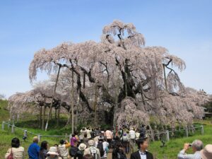
Spring (late March-early April) is the peak reason to walk this route. About 200 somei-yoshino cherry trees line the middle section’s levee, planted in the 1960s as a municipal beautification project and now large enough to form a continuous canopy over the path in peak bloom. The bloom window is typically March 28 – April 8. Almost no tourists; mostly local families.
Summer (June-August) is lush and green but exposed — the levee has limited shade in most sections and Ashikaga summer temperatures regularly hit 35°C with high humidity. The stream itself is a place small neighbourhood children play; fireflies appear in the upper reaches in mid-June for about two weeks.
Autumn (mid-October to late November) brings yellow/red foliage on the stream-side trees (mostly zelkova and maple rather than the spring-flowering cherries, so the autumn show is in different species). This is arguably the quietest season along the path; weekdays you’ll have it almost entirely to yourself.
Winter (December-February) is sparse and cold but empty. If you want genuine quiet in an accessible-from-Tokyo walking environment, this is the season.
The Flower Walking Course context
The Sakasagawa walk is usually done as part of Ashikaga’s broader “花のウォーキングコース” (Hana no Walking Course, “Flower Walking Course”) — a municipal trail network that loops through a dozen of the city’s small parks and river corridors. The full loop is about 10km, well-signed in Japanese (English signage is thin), and takes a moderate walker 2.5-3 hours at a leisurely pace with stops.
The main nodes on the loop, in order:
- Ashikaga Station (start/end) — the urban anchor.
- Watarase riverside (first 1km) — flat riverside promenade.
- Sakasagawa riverside (middle 2-3km) — the section this article covers.
- Ashikaga Park (3-4km mark) — a mid-size municipal park with seasonal flower beds, a playground, a small pond.
- Yamamae Park (4-5km) — a hillside park with panoramic Ashikaga views and walking paths.
- Residential district back to station (5-10km) — passes near the Ashikaga Textile Tradition House and other smaller sites.
For tourists specifically, the full loop is probably too much for a single visit unless walking is the main reason you’re in town. A more realistic approach: walk the Sakasagawa section (1-1.5 hours) and combine with the other Ashikaga sights (Banna-ji, Orihime Shrine, lunch) for a proper full day.
Nearby sites worth combining
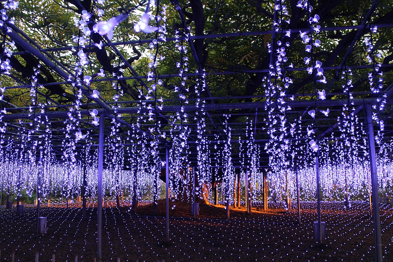
Ashikaga Flower Park — the most famous local park, 20 minutes by train west of central Ashikaga. The 150-year-old fuji (wisteria) tree is the park’s signature — in late April the canopy becomes a violet ceiling that’s been featured in everything from CNN to Studio Ghibli concept art. Peak bloom April 20 – May 10; free to combine on the same train day with an Ashikaga walk.

Banna-ji and the Ashikaga clan temple complex — central Ashikaga’s main cultural attraction. 15-minute walk south from the Sakasagawa course (specifically from where the walk ends at the Watarase River).
Orihime Shrine — the hilltop matchmaking shrine, 10-minute walk from the southern end of the Sakasagawa course. Covered in our Orihime Shrine guide.
Ashikaga School — Japan’s oldest educational institution (9th century), in the Banna-ji precinct.
Ashikaga Textile Tradition House — a small museum of Ashikaga silk-weaving history, about 15 minutes north of the station and partly on the broader Flower Walking Course. Free entry, open 9:00-16:00.
Getting there and walking it
From JR Ashikaga Station, exit the north side of the station and walk 15-20 minutes northeast along Ashikaga’s main commercial street. The path’s southern trailhead is at the Sakasagawa/Watarase confluence, near a small signed car park. Alternative trailhead: the northern end at Ishibashi-cho, reached by a 10-minute taxi or local bus from the station.
Walking direction: most people start at the southern/downstream end (near the station) and walk upstream. The gradient is barely perceptible (about 1 metre per km of fall), so direction is mostly a matter of where you want to end up. Downstream ends near central Ashikaga’s restaurants and the train station; upstream ends in a residential area with limited services.
The signage along the path is Japanese-only but the path itself is obvious. A smartphone with Google Maps open (or the offline Japan maps in Organic Maps/Maps.me) handles wayfinding adequately.
Practical notes
No public toilets along the walk. Go at the station before starting. The Flower Park has proper facilities if you’re continuing there.
No cafés or food stalls on the walk itself. Bring water; snacks if you need them. The return to central Ashikaga has plenty of normal restaurants — the local specialities are sobanomi soba (buckwheat-groat noodles) and Ashikaga shine-muscat grapes in September-October season.
Dog-friendly — the path is one of the more popular dog-walking routes in northern Ashikaga. Leash rules apply.
Ankle-high shoes recommended — the path surface is compacted gravel or grass rather than paved, and the levee edges can be muddy after rain.
Bicycles allowed on the wider sections but not the final 500m at the southern end. If you’re cycling, plan a route that uses the Watarase riverside path for the last stretch into the city centre.
Where to stay
Ashikaga’s accommodation cluster is thin — see the Orihime Shrine guide for the local business-hotel options. For the Sakasagawa walking specifically, a same-day trip from Tokyo is completely workable: 2 hours train each way, 2 hours walking, lunch and one temple visit in between.
If you want a wider Ashikaga itinerary, Oyama or Utsunomiya work better as overnight bases. Booking.com’s Ashikaga listings cover the immediate options.
Is the walking course worth doing?
For Ashikaga completionists — yes, easily. If you’re in town specifically to explore the city’s less-famous corners, the Sakasagawa adds an afternoon of quiet walking to an itinerary that’s otherwise concentrated around the station and the Orihime Shrine.
For cherry-blossom purists — yes, in peak early-April. Empty levee path, 200 mature cherry trees, zero tourists compared with Tokyo or Kyoto. Worth the train journey for the specific combination.
For general Tochigi visitors — probably skip. This is a neighbourhood walk rather than a destination; if you have time for only one Ashikaga thing, do Banna-ji or the Flower Park.
For solo walkers, writers, or photographers looking for the unglamorous everyday Japan — excellent. You’ll be walking past working vegetable gardens, school-age kids on bikes, older neighbours out with dogs. That specific register of “real Japan” is hard to find in the more famous destinations.
FAQ
Is the path signposted in English?
Barely. A few English panels at the trailheads and at the main bridges. The path itself runs through enough residential neighbourhoods that you’d benefit from having an offline map.
Can I walk the whole Ashikaga Flower Walking Course?
Yes, 10km takes about 3 hours at a steady pace with minimal stops. The municipal tourism office publishes a bilingual PDF map of the full loop — pick it up at the station information kiosk or download from the city website.
How bad is the summer heat on this path?
Bad. July-August afternoons along the exposed levee sections regularly hit 35-37°C with no meaningful shade for stretches of 200-400m. Plan for early morning (6-8am) or evening (after 17:00) walks in summer. Heat stroke is a real risk for unprepared walkers.
Are there any specific views or photo spots?
The cherry canopy section (middle 1.5km) is the main photo target in spring. In autumn, the confluence at the Watarase has some of the better foliage reflections in the water. There’s also a small red-painted footbridge about halfway along the course that’s a favoured local photographer’s framing point.
What else do locals do along here?
It’s a working neighbourhood path rather than a tourism site, so you’ll see what locals do in everyday Ashikaga — dog-walking, jogging, kids biking to school, older people doing morning stretches at the wider bench areas. Feel free to nod and say ohayo (morning) or konnichiwa (afternoon) as appropriate; Ashikaga residents are generally friendly to foreign walkers.
How does this compare to walking along the main Watarase River?
The Watarase is bigger, more built-up (a proper urban-park riverside), and has more infrastructure (paved paths, benches, small cafés). The Sakasagawa is quieter, smaller-scale, and more agricultural-suburban in character. If you want a standard riverside walk, do Watarase. If you want something more off-the-beaten-track, do Sakasagawa.
